
Mountain navigation essentials
Build your confidence and safety in the hills with a day out learning how to navigate. You’ll learn how to read a map, use a compass and simplify navigation to travel safely in any conditions.
Whether you’re totally new to navigation or looking to refresh your skills, this day will give you the foundations for exploring the mountains safely and plan bigger adventures.

Why learn to navigate?
Navigation is the key to freedom and safety in the mountains, no matter where you want to go.
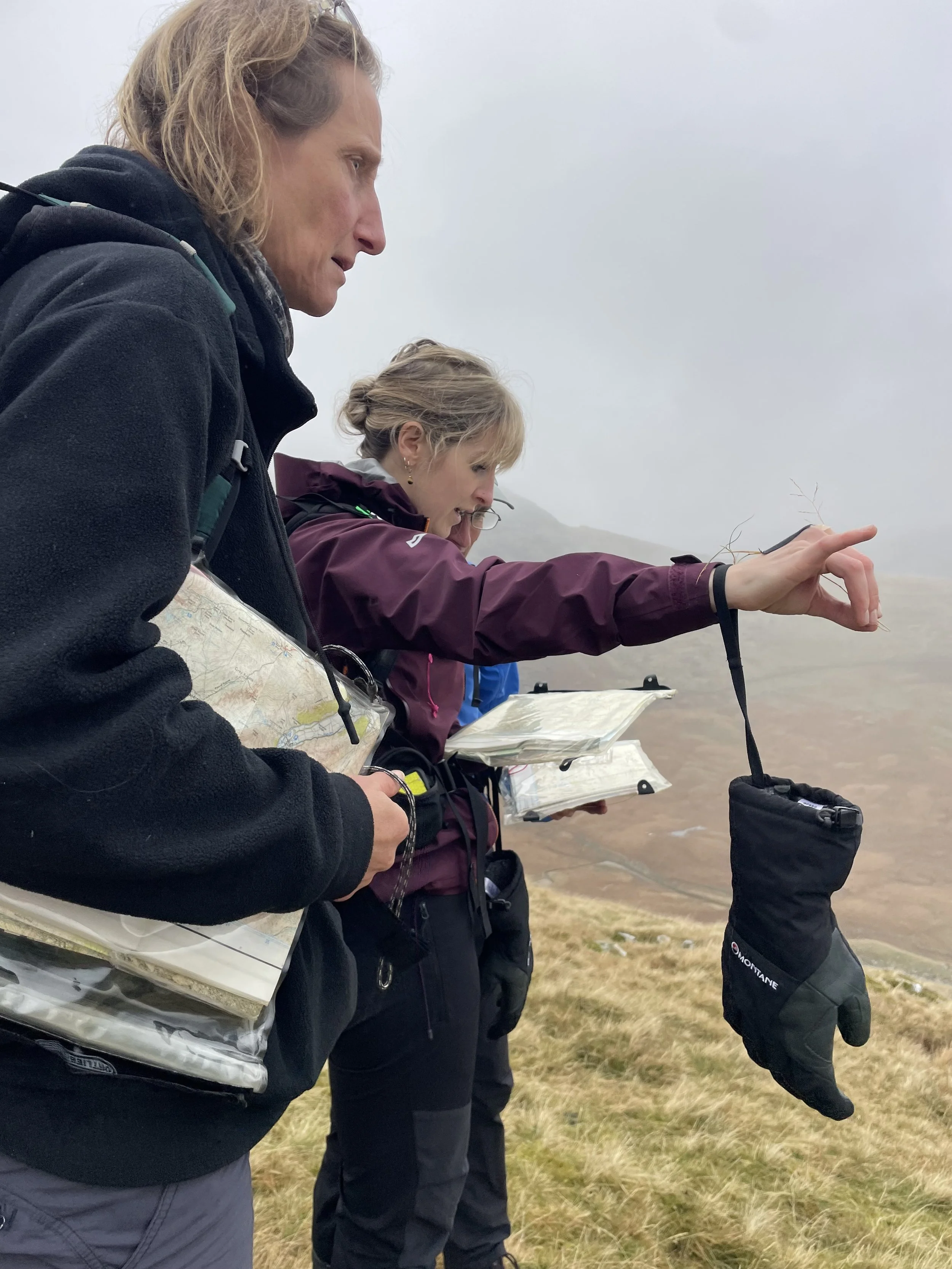
A lot of people struggle because they’re used to just following a line on their phone or their watch. I think of that as being a reactive navigator: always responding to what the screen tells you rather than paying attention to where you are and why. It might be convenient, but it’s risky- phone batteries die, the weather can turn rubbish, or you might have to change your route. Anyone who’s tried using a touchscreen in the rain with freezing cold hands knows how quickly ‘convenient’ can suddenly become scary and dangerous.
By learning how to read a map and use a compass (whilst carrying a GPS phone as a backup) you can get the best of both worlds. You’ll feel more connected to the landscape around you and you’ll learn how to relate that to your journey and the map. That’s what makes a proactive navigator: someone who can anticipate, adapt and see the bigger picture, no matter what the mountains throw at them.
By the end of our day together, you’ll have the skills to navigate quickly and efficiently, and appreciate more of your surroundings.

Who’s this day for?
Hillwalkers, runners, or anyone wanting to build or refresh their navigation skills
People planning for their first wild camping or backpacking trip
Someone preparing for a long-distance trek overseas
No previous experience is required, just enthusiasm and the willingness to learn outdoors.
What we’ll cover
Reading and interpreting maps and contours
Breaking your journey into legs and seeing the ‘story’
Using a compass accurately and intuitively
Estimating distance and timings on the move
Staying found: relocation and decision-making strategies
Using GPS and smartphone apps as a reliable back-up
Route planning and adapting to changing weather
You’ll learn how traditional and digital tools can work together- from compass bearings to thoughtful use of mapping apps and GPS units, with an emphasis on simplicity, flexibility and understanding the terrain.
What others say
“I contacted Rich after I’d entered a self-navigating, multi-day race on the Pennine Way. Unsure of 'proper' navigation with a map and a compass, from years of using gpx files I decided it was time to learn the ropes and soak in all information that was available. Rich was absolutely excellent in delivering the knowhow and expertise to help me not only self-navigate but to execute it with confidence. Charming, helpful and overflowing with information, Rich is the man to show you the way!” - Mike
Format
Duration: 1 full day
Group size: One-to-one or private groups (max 4)
Locations: Lake District, Yorkshire Dales or other areas by request
Price: From £200 per day
Included: Pre-trip planning support and post-course feedback resources. Maps, compasses and other kit can also be provided by me, depending on group size/location.