
Into the Magic Valley
Backpacking on the
Via Alta Vallemaggia
10 days, 200km and 18,000m of ascent across the wild mountains of Ticino.

The Via Alta Vallemaggia is a high elevation, long-distance hiking route in the Italian-speaking Swiss canton of Ticino. The Valle Maggia stretches northwards from the shores of Lago Maggiore and is home to some of the most rugged and lightly-trodden mountains in the Alps - a dramatic landscape of remote, forested side valleys and deserted ridge lines.
Valle Maggia translates as “Magic Valley” and I like to think that this name comes from the geology - the heavily metamorphosed rocks of the Valle Maggia are full of crystals that twinkle and glisten wherever you walk. Regardless of the name’s origin, it’s definitely a magical place to explore.

Map credit: viaaltavallemaggia.ch
So let’s get the statistics out the way first:
The VAV is 200 kilometres-long, divided into 19 stages with a total ascent of 18,000 metres. The trail also includes technical sections of up to T5- in difficulty (think UK scrambling grade 2, but often with chains to assist you). The trail begins and ends in the town of Locarno (easily-accessible by train). In terms of accommodation and resupply options - there are frequent refuges along the route (both staffed and unstaffed) but almost nothing in the way of towns, villages or shops. For a thorough route guide, strip maps and links for booking huts, the excellent Via Alta Vallemaggia official website has everything you’ll need.

Whilst the above facts tell us something about the VAV, it’s important to factor in the terrain on this route. Although impeccably way-marked at every turn, the VAV often has no distinct trail at all - the terrain along the route is rocky, steep and demanding. Familiar concepts like estimated walking-time are altered dramatically when faced with massive boulder fields, glaciated slabs and scrambly ridges instead of a simple path. Still, don’t let all of this put you off - the difficulty of the terrain brings its own rewards on the VAV. The route weaves an unobtrusive and unforgettable line through some of the wildest places in the alps.
The plan
My journey along the VAV began in early August 2025. I’d planned to follow my own, modified version of the route which also took in some extra peaks and scrambles. Rather than using huts and accommodation, I aimed to stay flexible and self-sufficient - I packed a lightweight backpacking tent and about six days-worth of food. By covering long distances each day, I estimated that I could complete the whole trail within 10 days and would only need to make one resupply (in the small village of Fusio). This plan meant averaging around 20 kilometres and 2000 metres of ascent every day, which would turn out to be pretty ambitious on this trail…

Above: Setting out from Locarno on the shores of Lago Maggiore on day one.
A rought start
Day one wasn’t an easy introduction to the VAV…
My train arrived at Locarno beneath the full intensity of the August afternoon sun. Temperatures were well over 30 degrees and sweat drenched my back within minutes of leaving the train station.
The VAV technically begins at the summit of Cimetta. This southernmost peak of the Vallemaggia massif is perched far above Locarno itself. On the VAV website, walkers are advised to arrive at Cimetta by taking a scenic series of cable-cars, chairlifts and a funicular railway. As well as being a memorable way to begin this long mountain journey, it avoids an unrelenting 1400-metre climb straight up through the suburbs of Locarno and the surrounding forest.
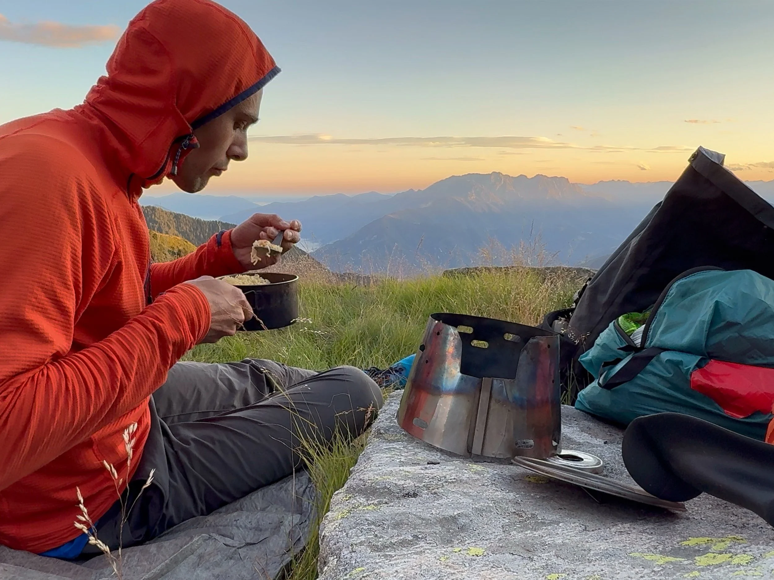
I was on a tight budget though, so I stubbornly committed myself to walking to the start point instead. The relentless afternoon sun and a rucksack crammed full of heavy food supplies quickly made this feel like a pretty masochistic way to begin my trip. After about four hours, I finally made it to Cimetta with aching shoulders and burning legs. I was rewarded by a view southwards over Lago Maggiore - the vast lake snaked its way between the mountains into Italy. It was already 5pm and I still had to cover a long stretch of ridge to reach my planned bivvy site before nightfall. By the time I arrived, the sun had set to leave a deep orange glow. The unmistakable silhouettes of Mont Blanc and Monte Rosa were cast across the distant horizon. I’d ascended over 2000 metres during that afternoon whilst weighed down with a very full rucksack and amidst the heat of the day. My body had received a sharp introduction to the demands of the VAV…
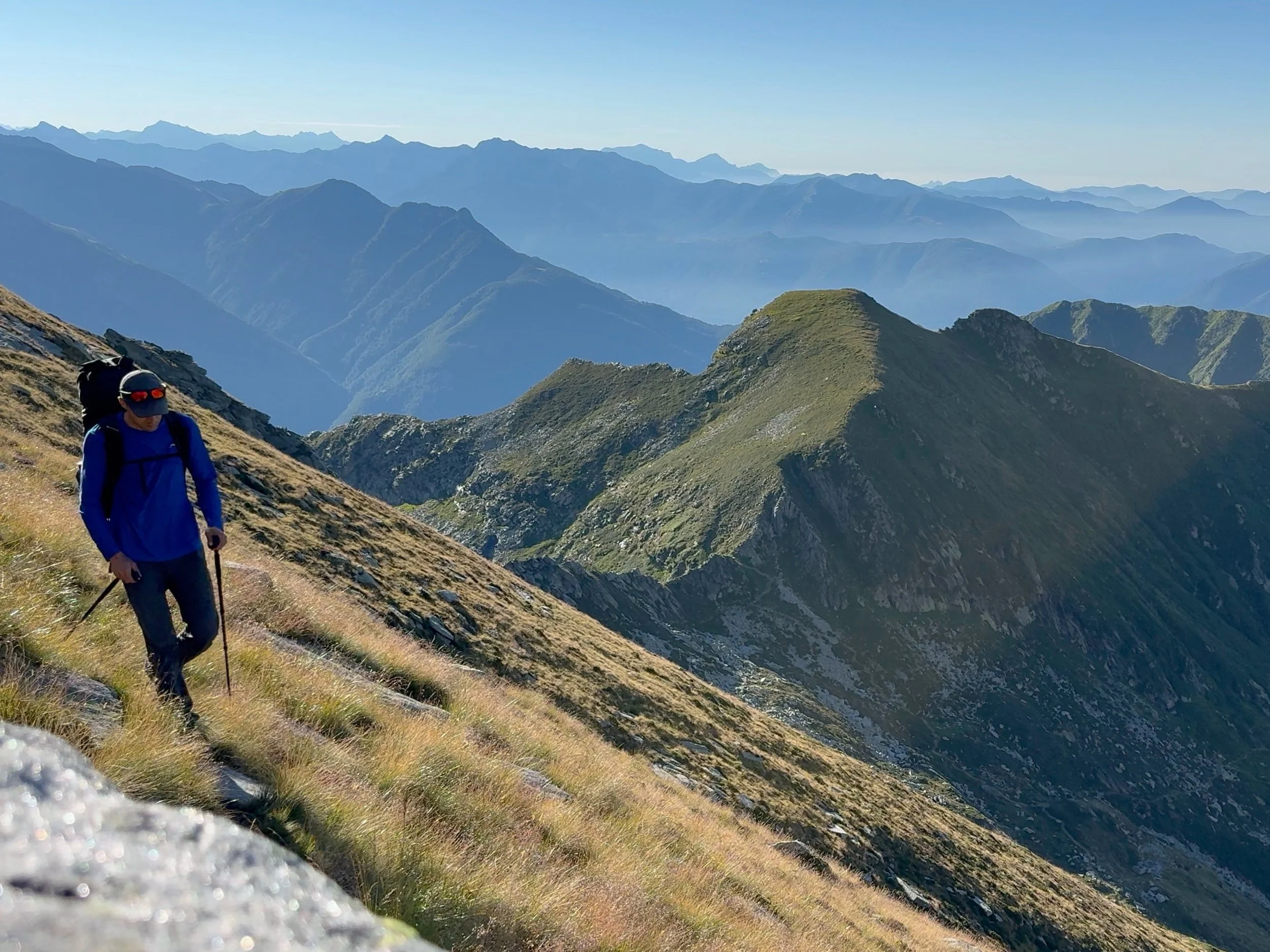
Above: Heading north from Cimetta at the beginning of the VAV- the wild ridges and steep forests of the Vallemaggia lay ahead.
Below: Tucking into dinner from my bivvy at the end of a tough first day.
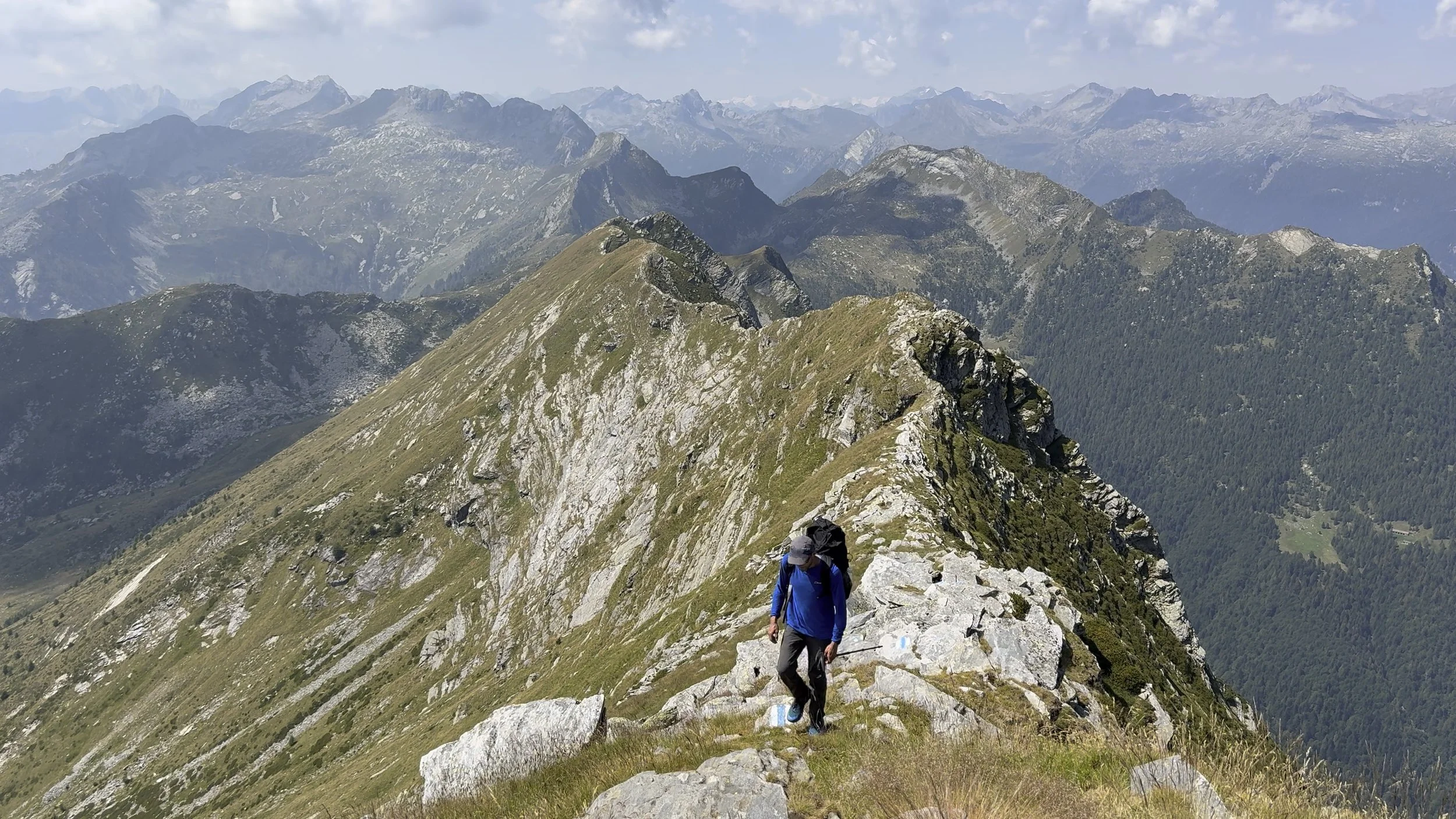
High ridges
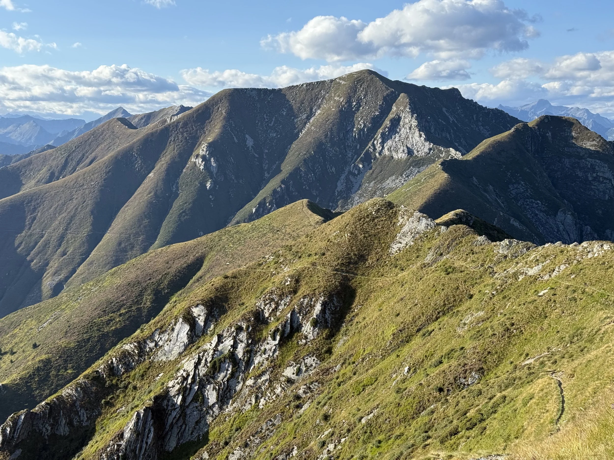
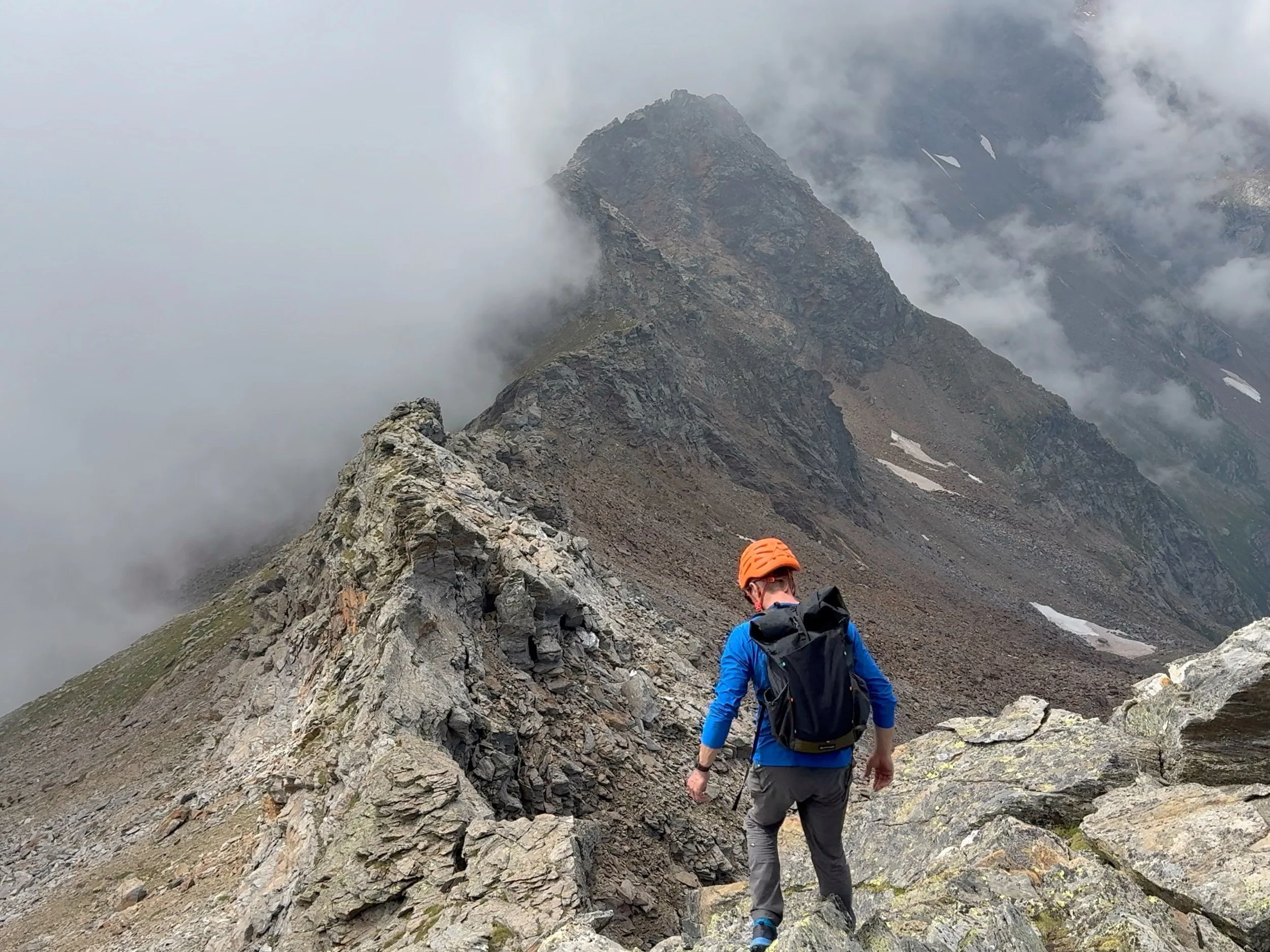
Days two and three saw me covering four stages of the VAV in quick succession. I followed a series of high ridges and steep side valleys perched between the Vallemaggia to the west, and the equally-spectacular Val Verzasca to the east. The highlight of day two was traversing the rocky peak of Madom da Sgiof. This was one of the more challenging sections of the VAV with a technical grade of T5-, meaning lots of scrambling along an airy ridge. Fortunately, the way-marking was excellent, and the reassuringly-shiny new chains that safeguarded the more difficult sections made it an enjoyable challenge, despite the added weight of a big rucksack.
Above: Traversing the airy ridge on Madom da Sgiof- one of the more challenging sections of the VAV.
Snakes and solitude
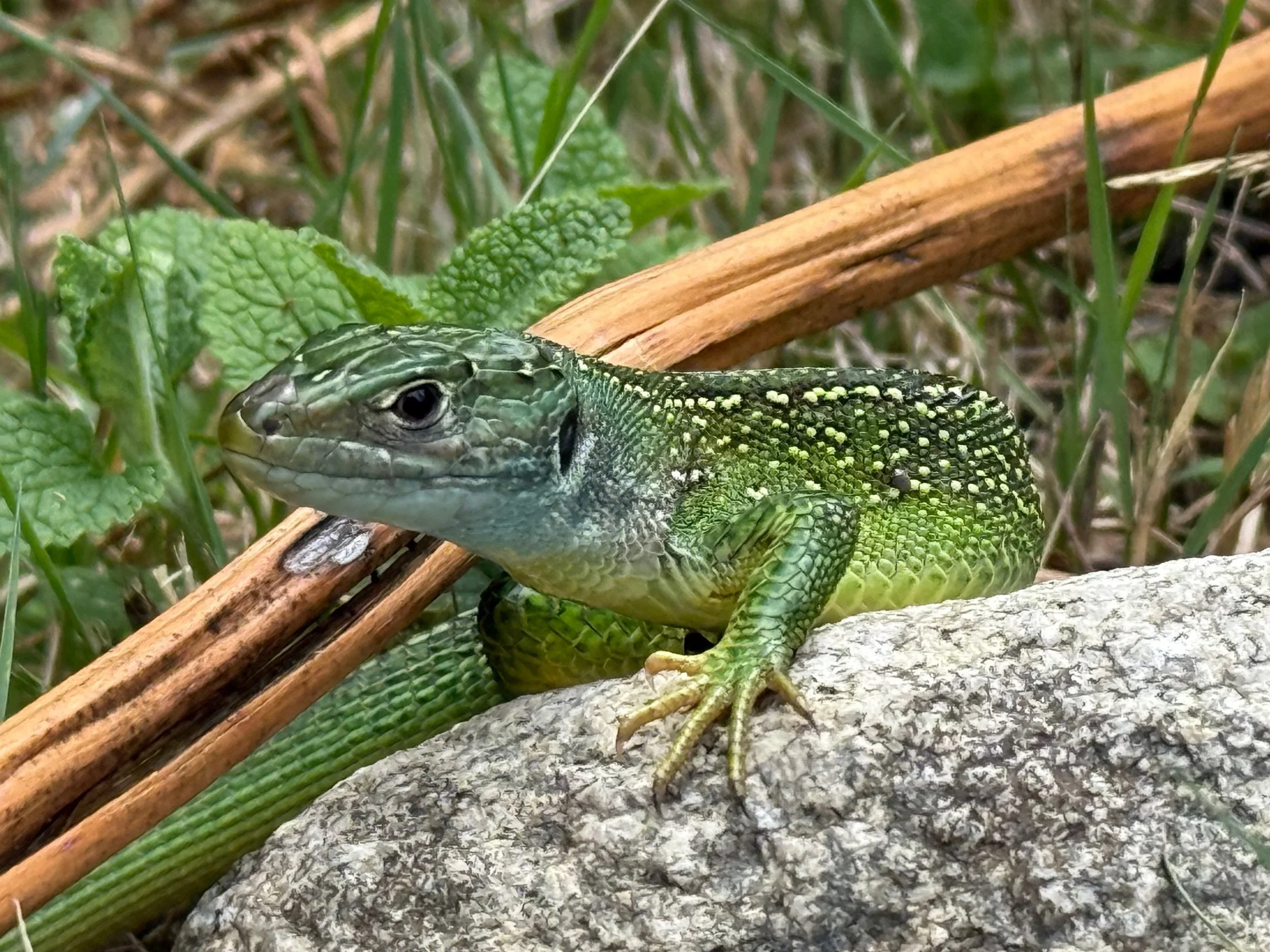
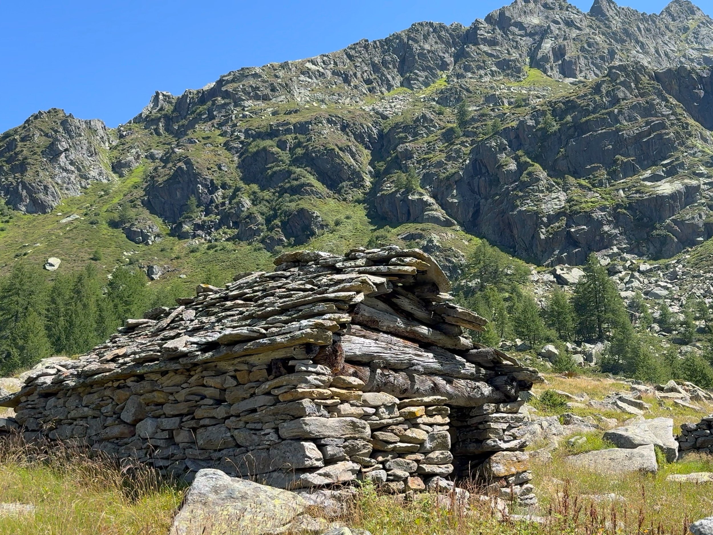
Rather than only following ridges, the VAV frequently led me down towards the tree-line as well. I wandered beside ancient, abandoned farm dwellings, through wild cirques and beside tranquil lakes. The trail was usually devoid of any other people, and the rough terrain made it difficult to average more than 2km per hour. I also had to watch my step to avoid the many lizards and asp vipers that lay hiding in the long grass. Unlike other parts of the Alps, walking along the VAV brought a real sense of wilderness. The steep valleys far below me were sliced with ravines and smothered in forest. Access to these quiet places was only possible via an unappealing and brutal slog up some long, lonely trail from the Vallemaggia far below- there were certainly no ski resorts anywhere.
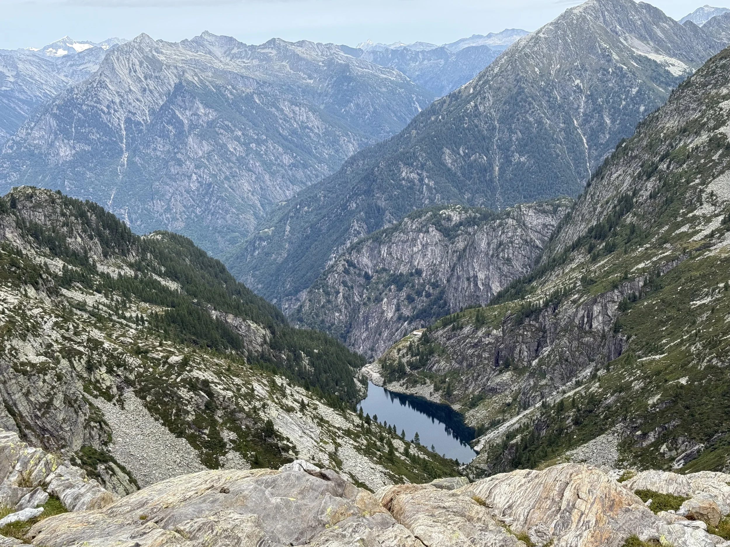
Above: Lago di Tomé.
Below: European green lizard.
Scrambling above the Val Puimogna
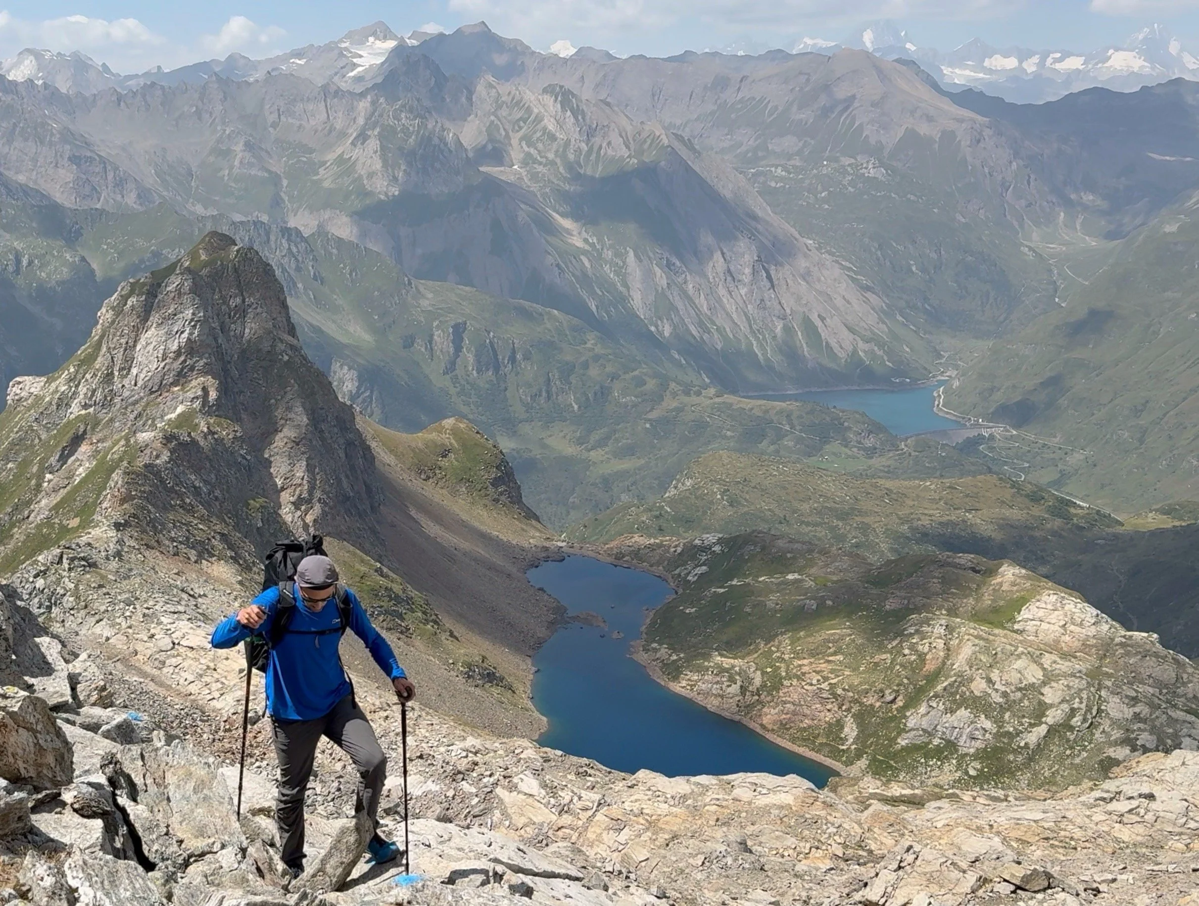
Days four and five of my journey saw me diverting off of the VAV, so that I could drop into the Val Piumogna. I wanted to explore some climbing possibilities on the peaks above this valley, the highest of which was Campo Tencia at 3071m. From Passo Ghiacciaione, I did a nice out-and-back ridge scramble to arrive on the summit of Pizzo Forno. Looking east, the mountains fell away from beneath my feet for 2000 metres, straight down into the bottom of the Leventina Valley. Whilst lying in my bivvy bag that night, some ibex wandered to within 5 metres of me and a cloud inversion filled the valley below like a swirling ocean.
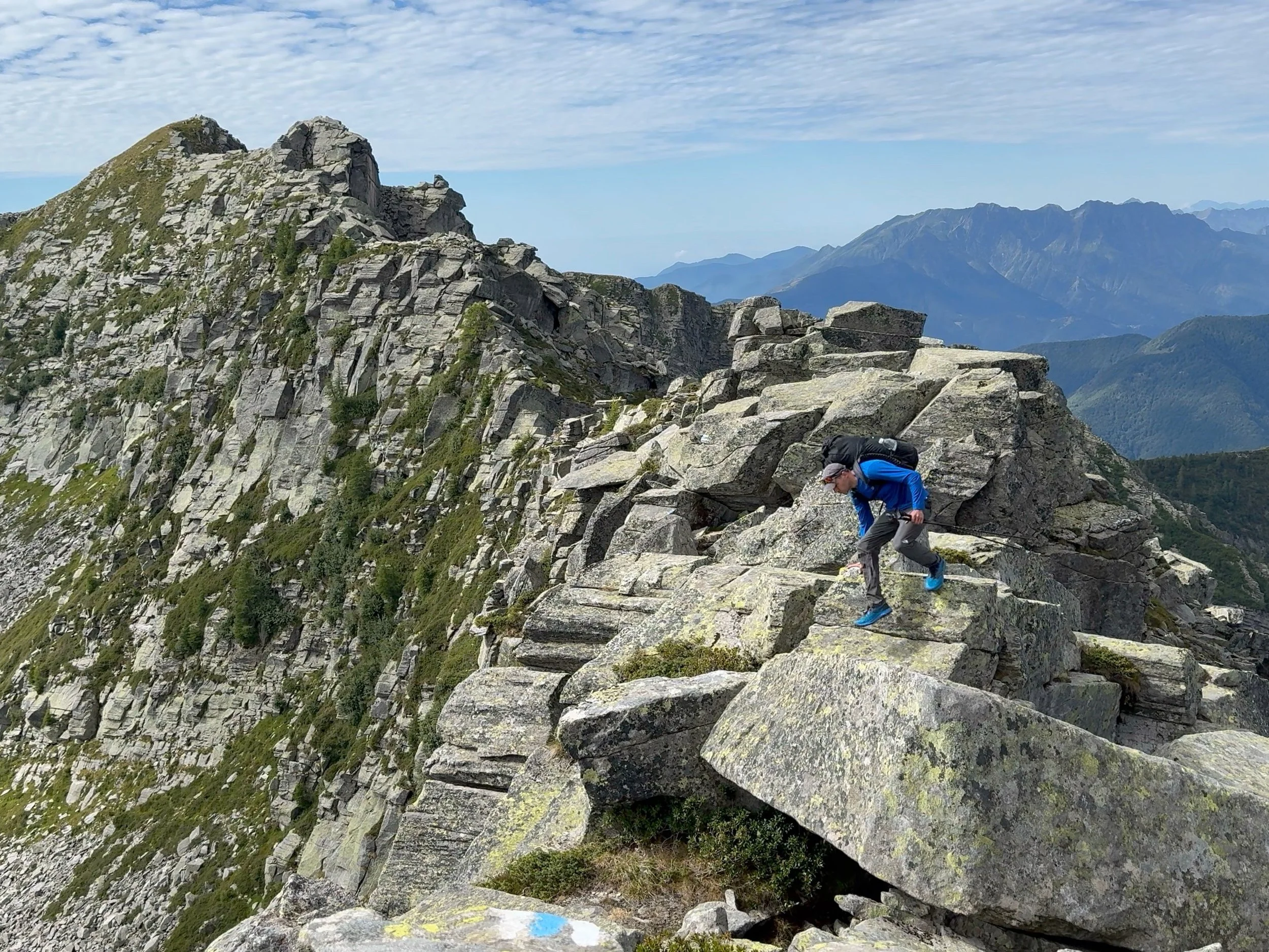
Above: Scrambling on Pizzo Forno during my short diversion from the VAV.
Below: Glacial lake above the Val Puimogna

Below: Rooftops of Fusio.
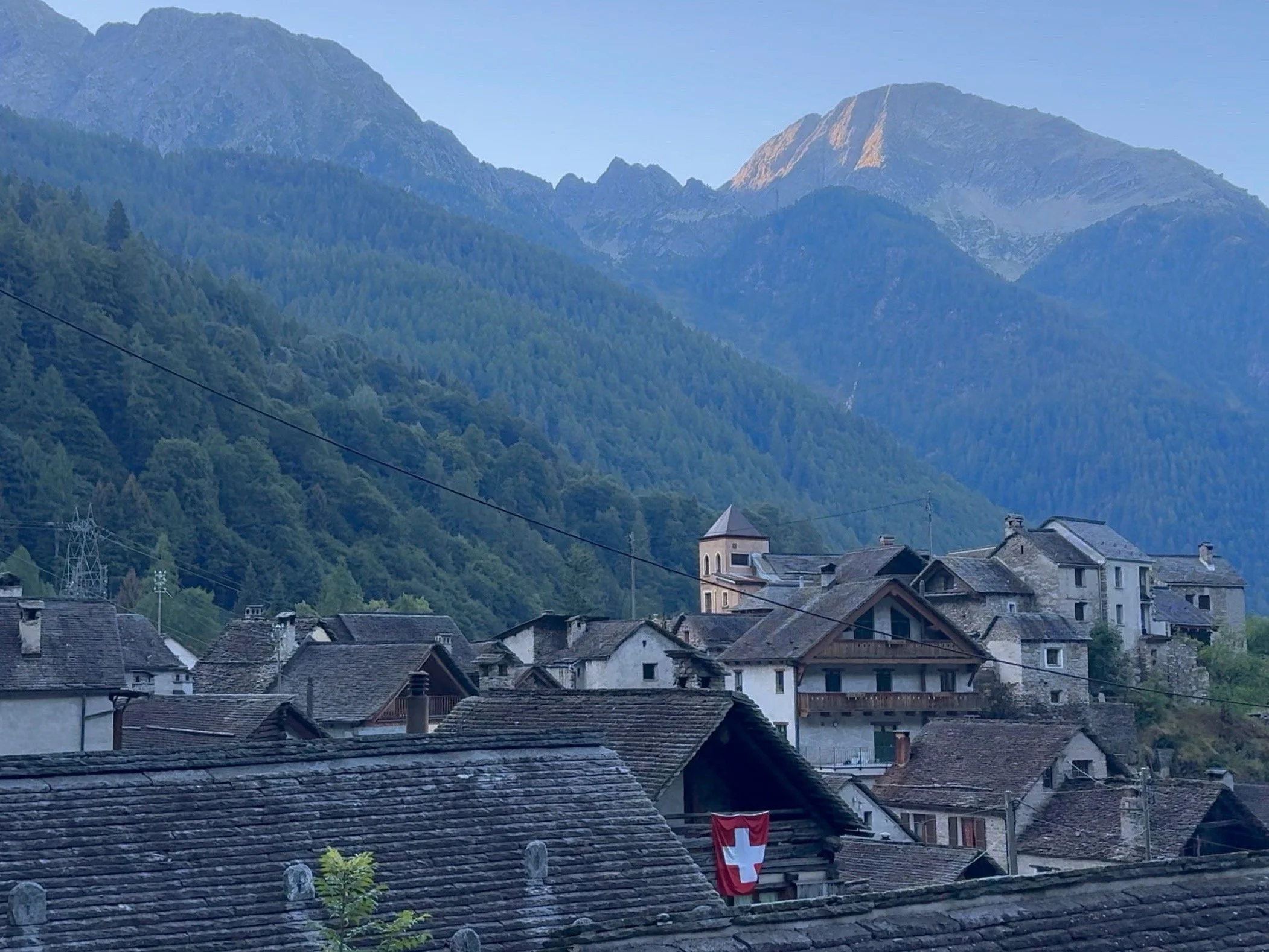
Taking stock in Fusio
By the end of day five, I was chuffed to have finally made it down to the little village of Fusio which lay nestled near the top of the Val Lavizzara. It was going to be my only night sleeping in accommodation during the whole journey, and also my only resupply point. I stayed at a lovely village hostel where a shower was extremely welcome. After a quick return journey on the bus to a little village shop in Sornico, I was sorted with food for the rest of my walk.
Although it was a relief to get my admin sorted, things weren’t all going to plan. After studying the map and the weather forecast from my hostel, I realised just how tough the remainder of my journey was likely to be.
After five days of tough walking, I was still under halfway along the VAV. This meant that I needed to cover even more daily distance to finish within my 10-day time limit. To make things more difficult, a heatwave was about the begin. Not only would the intense heat make hiking a lot more exhausting, but the heatwave would also eventually break to cause a period of stormy weather. Because of the climate and topography, thunderstorms in Ticino can be particularly violent - with flash floods and mudslides becoming a real possibility in some of the high valleys. If the forecasted storms arrived before I reached the end of the VAV, then I’d run out of time to finish. All I could do was try to stick to my planned itinerary despite the brutal heat and hope that the storms didn’t arrive too early.
Beating the heat
I set out from Fusio on day six as early as possible. I was determined to cover as much ground as I could before the powerful sun emerged above the surrounding peaks. The trail I followed from Fusio up to the pass of Bocchetta di Pisone was once overgrown and forgotten, until the creators of the VAV cleared debris and revived it with new way-marks. I followed these through beautiful forest, then over alpine meadows full of gentians into a landscape of shattered rock. I watched in silence as an eagle soared amongst the cliffs above my head. Old, derelict farm buildings hinted at the original creators of the trails in these parts - back when the alps were still full of wolves and bears, shepherds had to live up in the high pastures with their animals for the entire summer. As farming practices changed and rural depopulation increased, many of these old trails fell out of use.
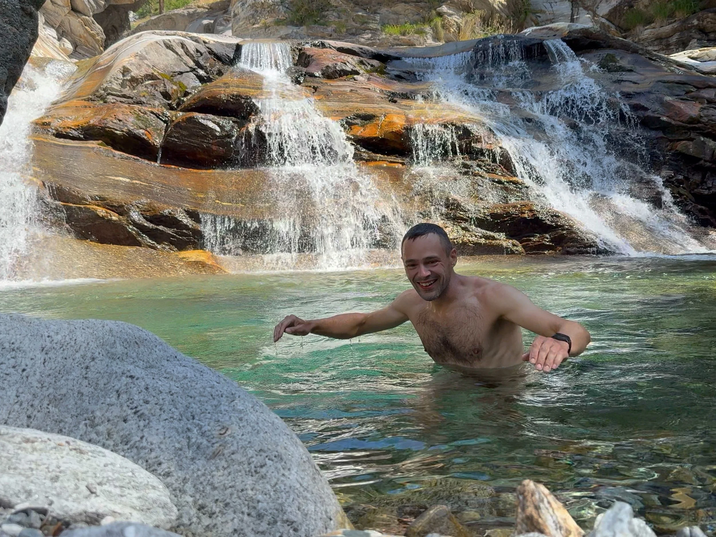
As I dropped down into the Peccia Valley, the sun had well and truly arrived with soaring temperatures. I plunged myself into the cold river at every opportunity and consumed many litres of water. I crossed the Cristallina massif in a dehydrated daze - the barren, shadeless landscape offered no respite from the oppressive heat. Looking across the Val Bavona, I could see the north face of Basodino. The final surviving scraps of glacier in the entire canton of Ticino clung to its immense slopes but were melting away before my eyes.
With the heat finally fading into the late afternoon, I pushed stubbornly onwards for many more hours until finally collapsing into my bivvy bag beneath Passo Grandinagia. It would turn out to be one of the biggest days of my trip - I’d made over 3,100 metres of ascent and a distance of 25 kilometres.

Above and below: Cooling off in the Peccia Valley.
Into Italy
The heat continued on day seven as the VAV led me briefly into Italy to traverse the eastern side of the Val Formazza above a series of dammed lakes. These gentler trails soon gave way to more off-trail scrambling, as I made a steep climb over Tamier Pass at 2772 metres. On the other side beneath the crumbling moraines of Basodino lay one of the most magical places on the entire VAV. The peaceful meadows of the Val d’Antabia are surrounded by incredible rock formations in every direction and the place has a timeless feel about it. I stopped by at the Capanna Piano del Creste. The refuge is surely one of the most beautiful in the Alps - a collection of ancient, stone farm buildings that were lovingly-restored by the local alpine association during the 80s. I received a warm welcome from the hut’s guardians and a delicious dinner of polenta with meat, vegetables and lentils. It was my first proper meal in a week.
Above: Climbing towards Tamier Pass above the Val Formazza.
Below: Stopping by at Capanna Piano del Creste.

Off-trail above the tree line
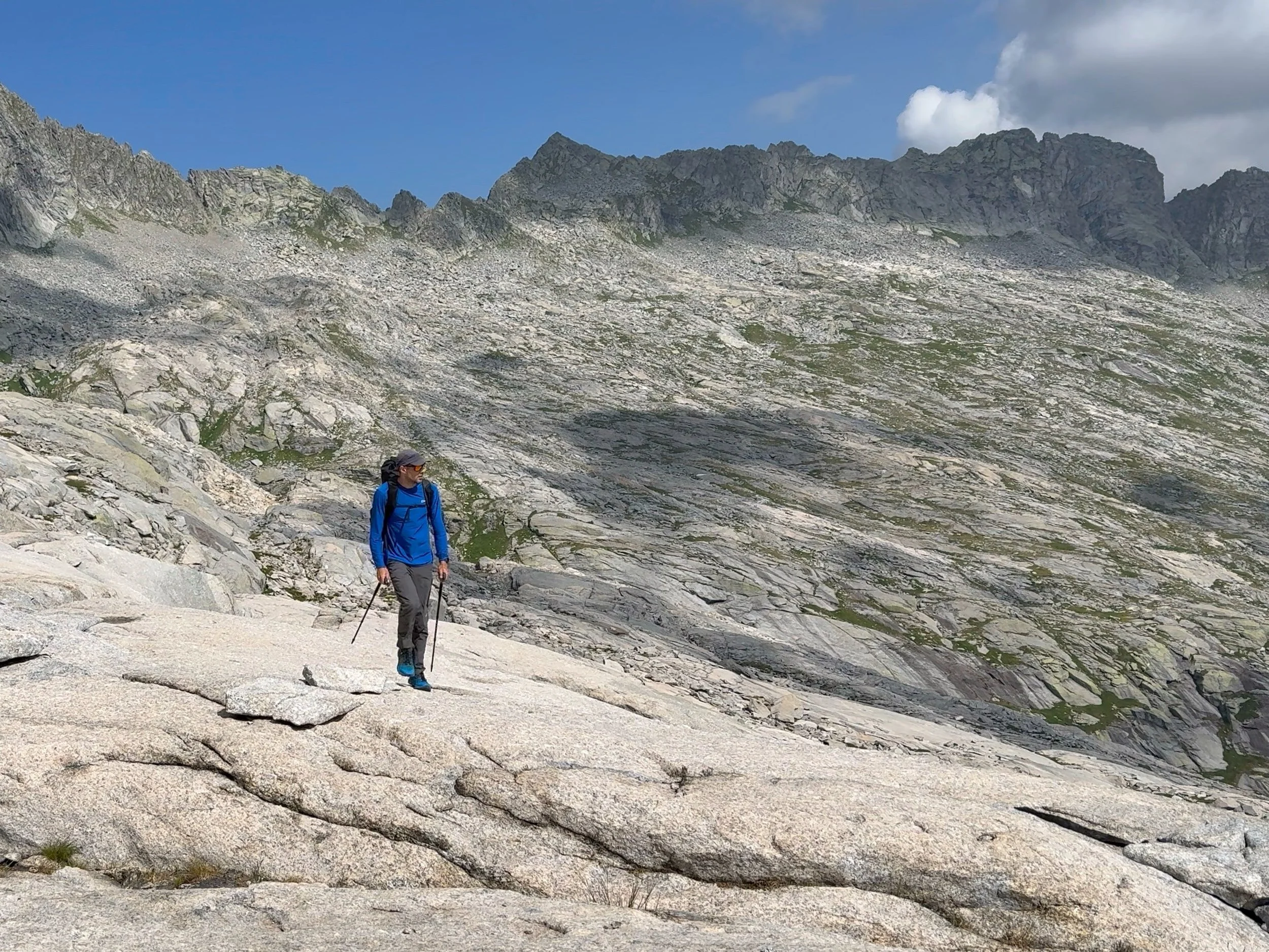
Day eight brought with it some of the most rewarding sections of the VAV, as I traversed a series of high and remote hanging valleys on rocky terrain with no defined trail. From the Val d’Antabia, I crossed a steep col and followed painted way-marks over slabs and boulder fields for hours whilst looking down on glacial lakes and secluded valleys. I was relieved to have a light enough rucksack to be able to cover ground quickly, as there were very few opportunities to refill my water amongst the high ridges surrounding Pizzo Cazzola. I was even more relieved that the forecasted storms had still not materialised. As sweaty and exhausted as I was in the heatwave, at least I didn’t need to worry about lightning. Peaceful larch forests embraced me on a descent into the Valle di Campo and after yet another big climb back up the other side, I was rewarded with a lakeside bivvy that I’ll never forget. Crystal clear reflections, silence and connection to yet another magical place.
Above: crossing beautiful rock slabs in the hanging valley above Alpe della Crosa.
Below: looking down over Laghi della Crosa.

Below: chamois in the Bosco Gurin Valley.

Below: Larch forest in the Valle di Campo.


Above and below: An unforgettable bivvy at Lago di Sfii.

Racing to beat the storms
Day nine began with the afternoon threat of thunderstorms. With yet more high ridges to traverse, I wasn’t keen on hanging around. It was a relief to finally get off the long and exposed ridge on the peak of Cramalina. Looking to the south, I could see storm clouds forming over the Valle Vigezzo and I wondered how long my luck would hold out for. I was also descending from the high mountains, so the temperatures were becoming unbearable. As I descended from the final peak of Madone, it seemed that the storms would wait for another day and I could just soak in the golden evening light. From the grassy shoulder of Pino, perched above the sprawling, forested foothills of the southern Valle Maggia I looked over to the distant ridge lines where my journey had first begun all those days before. Words cannot describe how sweaty and tired I was, but my soul felt alive in a way that only a long mountain journey can bring.
Above: Crossing the exposed ridge during the ascent of Al Pizz Cramalina.
The final, sweaty conclusion
With the majority of the Valle Maggia behind me, day 10 simply involved a straightforward, 12-kilometre descent through the forested foothills to reach the end of the VAV at Ponte Brolla. Or so I thought…
Instead, I faced confusing footpath diversions and a meandering, endlessly undulating descent that somehow involved 700 metres of climb, before I finally emerged from the dense forest and into a furnace. It was 34 degrees in Locarno and the VAV had been a full-on, physical challenge right until the very end.
The Valle Maggia might not have been an easy mountain range to traverse, but that was all part of the experience. The VAV had led me through some of wildest and most memorable places in the Alps. I’d recommend the trail to any experienced hiker.
It’s worth noting that using the many refuges along the route and following a more conservative daily itinerary would make it a much less demanding mountain journey. So go and explore and The Magic Valley for yourself!

My itinerary
Day 1
Start: Locarno Finish: L Alp da Cansgéi
Distance: 16km Ascent: 2121m Descent: 526m
Day 2
Start: L Alp da Cansgéi Finish: Pascolo dei Laghi
Distance: 18km Ascent: 1847m Descent: 1721m
Day 3
Start: Pascolo dei Laghi Finish: Lago Barone
Distance: 18km Ascent: 2259m Descent: 1929m
Day 4
Start: Lago Barone Finish: Ghiacciaio Grande di Crozlina
Distance: 15km Ascent: 1967m Descent: 1679m
Day 5
Start: Ghiacciaio Grande di Crozlina Finish: Fusio
Distance: 15km Ascent: 913m Descent: 2307m
Day 6
Start: Fusio Finish: Passo Grandinagia
Distance: 25km Ascent: 3157m Descent: 2039m
Day 7
Start: Passo Grandinagia Finish: Laghetti d’Antabia
Distance: 23km Ascent: 1461m Descent: 1638m
Day 8
Start: Laghetti d’Antabia Finish: Lago di Sfii
Distance: 29km Ascent: 2098m Descent: 2780m
Day 9
Start: Lago di Sfii Finish: Legunc
Distance: 28km Ascent: 2472m Descent: 3098m
Day 10
Start: Legunc Finish: Ponte Brolla
Distance: 13km Ascent: 656m Descent: 1601m